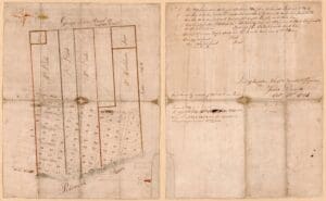
By the 1790s, the proprietors were laying off half-acre lots well beyond the built-up edge — William Hartshorne, Dr. Elisha Cullen Dick, and the Dade family north of Oronoco, others to the south and west — and houses were going up on ground that was not officially Alexandria at all. On December 13, 1796, the General Assembly passed an act adding those contiguous lots to the town, defining its limits as the lots on the north side of Montgomery Street, the District of Columbia line on the south, the lots on the west side of West Street, and the Potomac River on the east. As in 1786, the act applied only to lots already built upon; a second act in 1798 brought in the rest. Those lines defined the town for well over a century. Apart from a one-block extension north in the 1852 city charter to take in the Alexandria Canal, Alexandria did not grow beyond them until the annexation of 1915. (Shepherd, Statutes at Large of Virginia, vol. 2; the act’s preamble is quoted in Alexander v. Alexandria, 9 U.S. 1 [1809])